News about Colombia's Departments and Capitals
Articles and data about Colombia's departments.
Colombia is divided into 32 decentralized departments and the Capital District of Bogotá. Here you will find complete information about Colombia's departments and capitals with their respective population, area, demonym and much more.
The Republic of Colombia is politically divided into 32 decentralized departments and the Capital District of Bogotá. Below is the complete list.
Articles and data about Colombia's departments.
Below you will find a table with the basic information of Colombia's 32 departments: capital, natural region and number of municipalities in each department.
| # | Department | Capital | Region | Municipalities | Founded |
|---|---|---|---|---|---|
| 1 | Amazonas | Leticia | Amazonian | 2 | 1928 — 1991 |
| 2 | Antioquia | Medellín | Andean | 125 | 1856 — 1886 |
| 3 | Arauca | Arauca | Orinoquía | 7 | 1911 — 1991 |
| 4 | Atlántico | Barranquilla | Caribbean | 23 | 1905 |
| 5 | Bolívar | Cartagena | Caribbean | 46 | 1857 — 1886 |
| 6 | Boyacá | Tunja | Andean | 123 | 1857 — 1886 |
| 7 | Caldas | Manizales | Andean | 27 | 1905 |
| 8 | Caquetá | Florencia | Amazonian | 16 | 1909 — 1991 |
| 9 | Casanare | Yopal | Orinoquía | 19 | 1973 — 1991 |
| 10 | Cauca | Popayán | Andean and Pacific | 42 | 1857 — 1886 |
| 11 | Cesar | Valledupar | Caribbean | 25 | 1967 |
| 12 | Chocó | Quibdó | Pacific | 31 | 1906 |
| 13 | Córdoba | Montería | Caribbean | 30 | 1952 |
| 14 | Cundinamarca | Bogotá (D.C.) | Andean | 116 | 1857 — 1886 |
| 15 | Guainía | Inírida | Amazonian | 2 | 1963 — 1991 |
| 16 | Guaviare | San José del Guaviare | Amazonian | 4 | 1977 — 1991 |
| 17 | Huila | Neiva | Andean | 37 | 1905 |
| 18 | La Guajira | Riohacha | Caribbean | 15 | 1898 |
| 19 | Magdalena | Santa Marta | Caribbean | 30 | 1857 — 1886 |
| 20 | Meta | Villavicencio | Orinoquía | 29 | 1905 |
| 21 | Nariño | Pasto | Andean and Pacific | 64 | 1904 |
| 22 | Norte de Santander | Cúcuta | Andean | 40 | 1910 |
| 23 | Putumayo | Mocoa | Amazonian | 13 | 1905 — 1991 |
| 24 | Quindío | Armenia | Andean | 12 | 1966 |
| 25 | Risaralda | Pereira | Andean | 14 | 1966 |
| 26 | San Andrés y Providencia | San Andrés | Insular | 1 | 1912 — 1991 |
| 27 | Santander | Bucaramanga | Andean | 87 | 1857 — 1886 |
| 28 | Sucre | Sincelejo | Caribbean | 26 | 1966 |
| 29 | Tolima | Ibagué | Andean | 47 | 1861 — 1886 |
| 30 | Valle del Cauca | Cali | Andean and Pacific | 42 | 1910 |
| 31 | Vaupés | Mitú | Amazonian | 3 | 1910 — 1991 |
| 32 | Vichada | Puerto Carreño | Orinoquía | 4 | 1913 — 1991 |
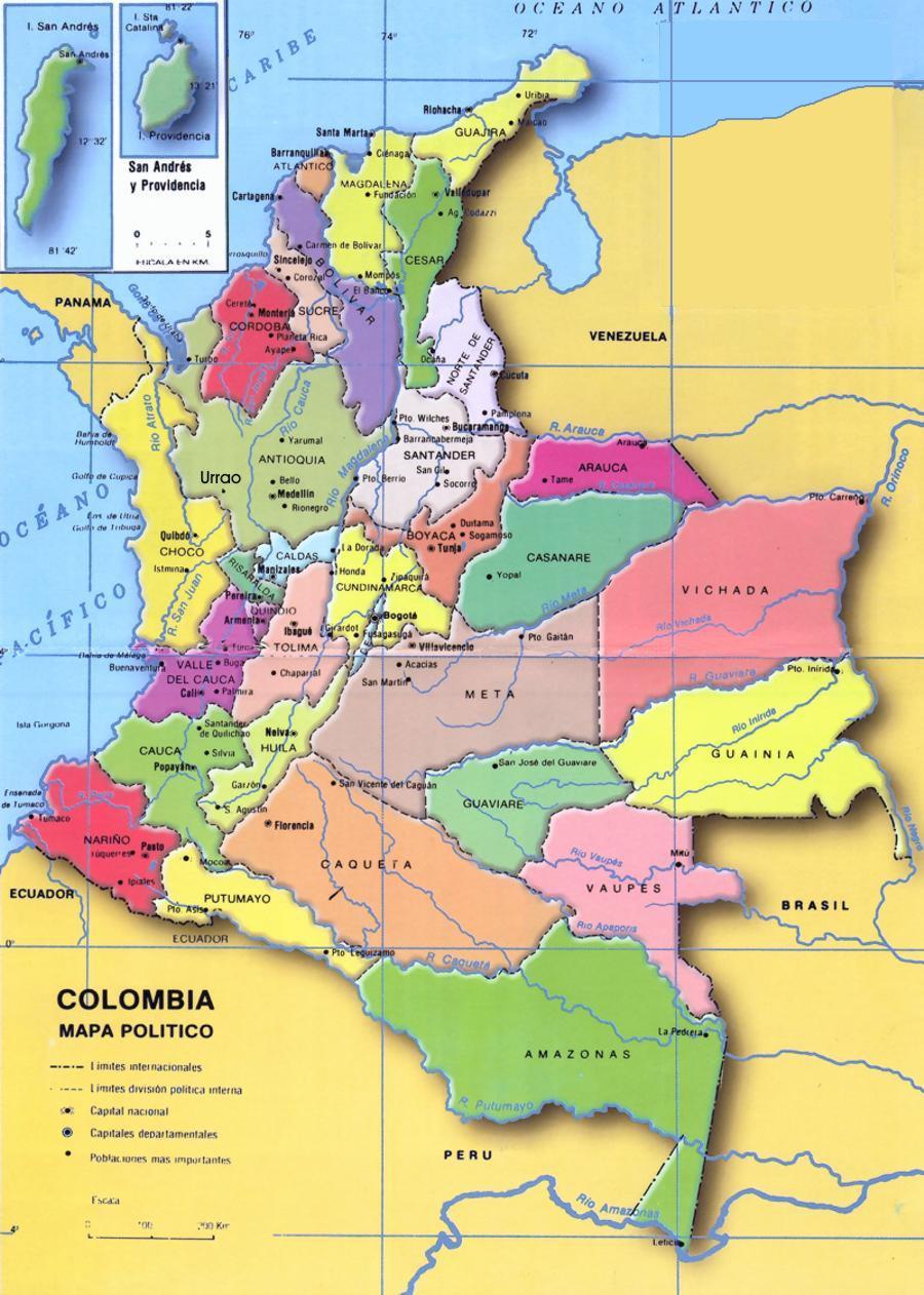
The political map of Colombia shows the 32 departments and the Capital District of Bogotá with their official borders, departmental capitals and geographic location within the national territory.
Colombia borders the Caribbean Sea to the north, Venezuela to the northeast, Brazil to the southeast, Peru and Ecuador to the south, and the Pacific Ocean and Panama to the west. Its total area is 1,141,748 km², making it the fourth largest country in South America.
Download Map of Colombia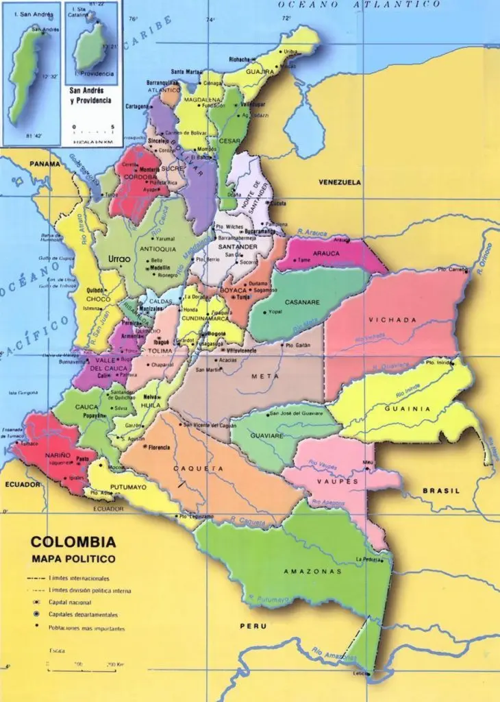
Key information about population, area and governors of Colombia's departments
Find information about the 6 natural regions of Colombia and discover the departments that belong to each one.
The most populated. It follows the three ranges and the cities of the center.
See region →Northern coast: 7 departments. San Andrés lies in the Caribbean Sea and forms the Insular region.
See region →Chocó and the coast of Valle, Cauca and Nariño. Cali, Popayán and Pasto sit in the cordillera.
See region →Eastern Plains: Arauca, Casanare, Meta and Vichada.
See region →Six rainforest departments. Meta and Vichada are not in this list.
See region →San Andrés and Providencia. Other islands do not add departments.
See region →Frequently asked questions about the structure, functioning and administration of Colombia's departments.
A department in Colombia is a type of subnational entity, above a municipality. Colombia is divided into 32 departments and the Capital District of Bogotá, each with their own administrative powers headed by a governor elected by popular vote.
Although the term was initially used in France, many Latin American countries have adopted this type of territorial division. Colombia's departments have their own administrative structures and departmental assemblies.
Colombia has 32 departments and the Capital District of Bogotá. DANE Divipola (23 September 2026) lists 1,103 municipalities and 18 non-municipalized areas (ANM). The older 1,133 figure mixed municipalities with departmental corregimientos. See the municipalities of Colombia list.
Colombia's departments are governed from their respective capital cities by the figure of the department governor, elected by popular vote for a 4-year term. The departments are characterized by forming geographic, cultural and economic regions with similarities.
Each department also has a Departmental Assembly whose members — the deputies — are elected by popular vote.
Article 298 of Colombia's 1991 Political Constitution establishes that: "Departments have autonomy for the administration of sectional affairs and the planning and promotion of economic and social development within their territory."
The departments exercise administrative, coordination and complementarity functions for municipal action, serving as intermediaries between the Nation and Municipalities. — Source: Senate Secretariat
The departments are subdivided into municipalities. Municipalities in Colombia are administered by a mayor and municipal council, elected by popular vote for a 4-year term.
Some departments with a large number of municipalities have created subregions to facilitate administration. The best-known case is Cundinamarca, which has more than 100 municipalities organized into 15 provinces. However, these subregions have no legal recognition.
Colombia is described in six natural regions: Andean (13), Caribbean (7), Pacific (4: Chocó, Valle del Cauca, Cauca and Nariño), Orinoquía (4: Arauca, Casanare, Meta and Vichada), Amazonian (6) and Insular (1, San Andrés y Providencia). Valle, Cauca and Nariño appear in both the Andean and Pacific regions: the capital sits in the cordillera and the littoral is Pacific. San Andrés is Insular only. IGAC and IDEAM often describe five continental zones and treat the islands separately; natural zones overlap, so the lists do not add up to 32.