Department of Boyacá
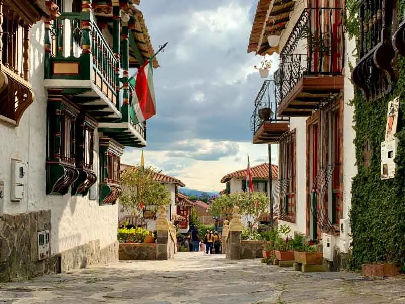
Boyacá is a department full of history about Colombia, located in the center of the country and with beautiful landscapes to enjoy.
The department of Boyacá is located in the Andean region, in the center of the country, its capital is the city of Tunja.
It borders to the north with Santander and Norte de Santander, to the east with Venezuela, Arauca and Casanare, to the south with Cundinamarca and to the west with Caldas and Antioquia.
Its astronomical position is between 5°17′ and 7°08′ north latitude, and 69°50′ and 73°43′ west longitude.
Boyacá is known for its history, as it was a protagonist in the colonial era, where battles were fought that ultimately led to Colombia's independence.
It was called by the liberator Simón Bolívar «Cradle and Workshop of Freedom».
In honor of the department of Boyacá, the Order of Boyacá was created in 1819.
Its name, Boyacá, has its origin in the Muisca word «Boiaca», which means «Region of the Royal Manta» or «Cacique's Enclosure».
It has a surface area of 23,189 km² and although it is not one of the largest departments in Colombia, it has played a very important role in the country's history.
IMPORTANT DATA
CAPITAL
TUNJA
INHABITANTS
1’281,979
DEMONYM
BOYACENSE
SURFACE AREA
23,189 km²
GOVERNOR
Carlos Andrés Amaya Rodríguez
OFFICIAL WEBSITE
Map of the Department of Boyacá
Next, the municipalities of Boyacá located on the map:
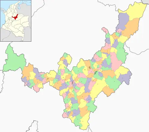
Map by: Wikimedia Commons / CC BY-SA
PROVINCES OF THE DEPARTMENT OF BOYACÁ
The department of Boyacá has 13 provinces, a special management zone and a border district with Venezuela, which are:
- Centro
- Gutierréz
- La Libertad
- Lengupá
- Márquez
- Neira
- Norte
- Occidente
- Oriente
- Ricaurte
- Sugamuxi
- Tundama
- Valderrama
- Zona de Manejo Especial
- Distrito Fronterizo
MUNICIPALITIES OF THE DEPARTMENT OF BOYACÁ
The department of Boyacá has 123 municipalities listed below in their respective province:
Centro
- Cómbita
- Cucaita
- Chíquiza
- Chivatá
- Motavita
- Oicatá
- Samacá
- Siachoque
- Sora
- Soracá
- Sotaquirá
- Toca
- Tunja
- Tuta
- Ventaquemada
Gutiérrez
- Chiscas
- El Cocuy
- El Espino
- Guacamayas
- Güicán
- Panqueba
La Libertad
- Labranzagrande
- Pajarito
- Paya
- Pisba
Lengupá
- Berbeo
- Campohermoso
- Miraflores
- Paéz
- San Eduardo
- Zetaquira
Márquez
- Boyacá
- Ciénega
- Jenesano
- Nuevo Colón
- Ramiriquí
- Rondón
- Tibaná
- Turmequé
- Úmbita
- Viracachá
Neira
- Chinavita
- Garagoa
- Macanal
- Pachavita
- San Luis de Gaceno
- Santa María
Norte
- Boavita
- Covarachía
- La Uvita
- San Mateo
- Sativanorte
- Sativasur
- Soatá
- Susacón
- Tipacoque
Occidente
- Briceño
- Buenavista
- Caldas
- Chiquinquirá
- Coper
- La Victoria
- Maripí
- Muzo
- Otanche
- Pauna
- Quípama
- Saboyá
- San Miguel de Sema
- San Pablo de Borbur
- Tununguá
Oriente
- Almeidar
- Chivor
- Guateque
- Guayatá
- La Capilla
- Somondoco
- Sutatenza
- Tenza
Ricaurte
- Arcabuco
- Chitaraque
- Gachantivá
- Moniquirá
- Ráquira
- Sáchica
- San José de Pare
- Santana
- Santa Sofía
- Sutamarchán
- Tinjacá
- Togüí
- Villa de Leyva
Sugamuxi
- Aquitania
- Belencito
- Cuítiva
- Firavitoba
- Gámeza
- Iza
- Mongua
- Monguí
- Nobsa
- Pesca
- Sogamoso
- Tibasosa
- Tópaga
- Tota
Tundama
- Belén
- Busbanzá
- Cerinza
- Corrales
- Duitama
- Floresta
- Paipa
- Santa Rosa de Viterbo
- Tutazá
Valderrama
- Betéitiva
- Chita
- Jericó
- Paz de Río
- Socha
- Socotá
- Tasco
Zona de Manejo Especial
- Puerto Boyacá
Distrito Fronterizo
- Cubará
HISTORY
During the pre-Hispanic period, it was inhabited by indigenous people belonging to the Chibcha, Muisca, Caribe, Pijaos, Sutagaos, etc. families.
The main explorers of the area were Gonzalo Jiménez de Quesada, Sebástián de Belálcazar, and Nicólas de Federmán, who arrived in the area in the 16th century.
In the independence, the department and its people were protagonists and scenarios of battles such as the one on August 7, 1819, at the Puente de Boyacá.
RELIEF
This area of the country is crossed from south to north by the Eastern Cordillera, where the Cordillera del Zorro, the Serranía de los Quinchas, the Cerros Fura, Tena, Leiva, among others, and the Sierra Nevada del Cocuy are located.
It is also important to highlight the Cañón del Chicamocha, the páramos Rusia, Guantiva, Chotales, Rechíniga, and Pisga.
HYDROGRAPHY
The department, in terms of water sources, is bathed by the Magdalena, Suárez, Chicamocha, Moniquirá, Minero, Gámeza, Pantanogrande, Teatinos, Mueche, Upía, Batá or Garagoa, Cusiana, Cravo, Sur, Pisba, Tocará, Casanare, Arauca, and other rivers.
The department also has important lakes and lagoons such as Tota, Socha, La Verde, Encantada, San Pedro de Iguaque, among others, as well as the Sochagota, Chivor, etc. reservoirs.
CLIMATE
It is a department with varied climate, typical of altitude or thermal floors, with an average temperature that oscillates between 30°C and 10°C.
ECONOMY
The quality of the department’s soil in terms of organic matter is very fertile, the cultivation of food products is good, the main productions are potatoes, cassava, bananas, wheat, corn, sugarcane, and coffee.
The mining production of emeralds, coquizable cement, steel, iron is also important, although it has decreased due to the closure of the Siderúrgica Paz del Río.
Livestock is another important sector of the department's economy, represented by cattle for milk, sheep, horses, and poultry.
Tourism is another important sector of the department's economy, with historical, cultural, and ecological sites.
NATURAL RESERVES
There are three natural reserves in the department:
- Parque Nacional Natural El Cocuy
- Parque Nacional Natural Pisba (with 45,000 hectares)
- Santuario de Fauna y Flora de Iguaque (with land between 2,400 and 3,800 meters above sea level).
ANTHEM
Lyrics: Pedro Medina Avendaño
Music: Jorge Camargo Spolidore
CHORUS
Forward to the summit that guards
the memory of so many immortals,
sweet land that extends its arms
from the west to the solar pampa.
I
In its entrails, there are gardens of iron,
gold is in the blond alluvium,
the green emerald shines
in the gray fog of the socavón.
II
Its men have always been first
in good, in war, in peace,
there is no lack of a star in the sky
in the soul, there is always a song.
III
That one brings eternal harmony
with the numen of Floréz and Ortíz,
it is a torch that opposes death
high wall of endless dawn.
IV
Others come from the fertile classroom
animated by the creative genius,
to sculpt on the wall of time
the hope of a better world.
You may also be interested in