Municipalities of Sucre
Complete list of the 26 municipalities of Sucre in alphabetical order, by population, climate and founding date, all the information of each municipality.
The department of Sucre belongs to the Caribbean region of Colombia, in the north of the country. With 26 municipalities distributed across five natural subregions —the Gulf of Morrosquillo, La Mojana, the Montes de María, the Sabanas and the San Jorge region—, Sucre combines Caribbean beaches, ecologically important wetlands and a rich cultural history of indigenous and African roots. Its capital, Sincelejo, is the economic and cultural engine of the department. Below you will find the complete list of the 26 municipalities of Sucre in alphabetical order, by population, climate and founding date.
LIST OF MUNICIPALITIES OF SUCRE IN ALPHABETICAL ORDER
Below is the list of the 26 municipalities of Sucre in alphabetical order:
- Betulia
- Buenavista
- Chalán
- Coloso
- Corozal
- Coveñas
- El Roble
- Galeras
- Guaranda
- La Unión
- Los Palmitos
- Majagual
- Morroa
- Ovejas
- Palmito
- Sampués
- San Benito Abad
- San Luis de Sincé
- San Marcos
- San Onofre
- San Pedro
- Santiago de Tolú
- Sincelejo
- Sucre
- Tolú
- Tolúviejo
Below is the list of the 26 municipalities of Sucre including the subregion to which they belong:
| Municipality Name | Subregion |
| Santiago de Tolú | Golfo de Morrosquillo |
| Coveñas | Golfo de Morrosquillo |
| San Onofre | Golfo de Morrosquillo |
| Tolúviejo | Golfo de Morrosquillo |
| Municipality Name | Subregion |
| Majagual | La Mojana |
| Guaranda | La Mojana |
| Sucre | La Mojana |
| San Marcos | La Mojana |
| San Benito Abad | La Mojana |
| Municipality Name | Subregion |
| Ovejas | Montes de María |
| Chalán | Montes de María |
| Coloso | Montes de María |
| Los Palmitos | Montes de María |
| Morroa | Montes de María |
| Tolú | Montes de María |
| Municipality Name | Subregion |
| Sincelejo | Sabanas |
| Corozal | Sabanas |
| Sampués | Sabanas |
| El Roble | Sabanas |
| Galeras | Sabanas |
| Betulia | Sabanas |
| San Luis de Sincé | Sabanas |
| Buenavista | Sabanas |
| Palmito | Sabanas |
| La Unión | Sabanas |
| San Pedro | Sabanas |
MUNICIPALITIES OF SUCRE BY POPULATION
Below the 26 municipalities of Sucre in a list sorted from highest to lowest population:
| Name | Inhabitants |
| Sincelejo | 286687 |
| Corozal | 72534 |
| San Marcos | 71456 |
| Sampués | 52834 |
| San Onofre | 47931 |
| Santiago de Tolú | 35628 |
| San Benito Abad | 30942 |
| Majagual | 30108 |
| Ovejas | 29647 |
| Galeras | 28512 |
| Los Palmitos | 26394 |
| San Luis de Sincé | 25721 |
| Sucre | 23548 |
| Guaranda | 22314 |
| Coveñas | 19187 |
| Betulia | 16253 |
| Morroa | 15748 |
| Tolúviejo | 15321 |
| La Unión | 14629 |
| Palmito | 14107 |
| San Pedro | 12894 |
| El Roble | 12463 |
| Buenavista | 11872 |
| Tolú | 8734 |
| Coloso | 7825 |
| Chalán | 5218 |
MUNICIPALITIES OF SUCRE BY CLIMATE
Below is the complete list of the 26 municipalities of Sucre ordered from hottest to coolest climate. Sucre has a predominantly hot and dry climate, typical of the Colombian Caribbean, with temperatures ranging between 27 and 35 degrees Celsius throughout the year:
| Municipality Name | Average Temperature |
| Guaranda | 35º c |
| Majagual | 34º c |
| Sucre | 34º c |
| San Benito Abad | 33º c |
| San Marcos | 33º c |
| La Unión | 32º c |
| Galeras | 31º c |
| Santiago de Tolú | 30º c |
| Coveñas | 30º c |
| San Onofre | 30º c |
| Tolú | 30º c |
| Corozal | 29º c |
| Sincelejo | 28º c |
| Sampués | 28º c |
| Los Palmitos | 28º c |
| Palmito | 28º c |
| El Roble | 28º c |
| Buenavista | 28º c |
| San Luis de Sincé | 28º c |
| San Pedro | 28º c |
| Tolúviejo | 27º c |
| Betulia | 27º c |
| Morroa | 27º c |
| Ovejas | 27º c |
| Coloso | 27º c |
| Chalán | 27º c |
DATE OF FOUNDATION OF MUNICIPALITIES OF SUCRE
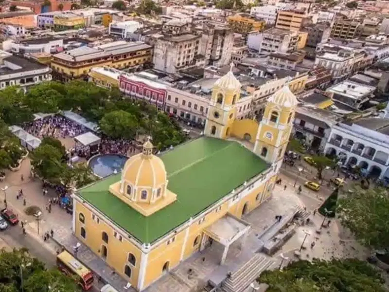
Santiago de Tolú is the oldest municipality in the department of Sucre, founded in 1535 by Pedro de Heredia, making it one of the earliest colonial settlements on the Colombian Caribbean coast. Sincelejo was founded in 1535 as a small hamlet that over time became the capital of the department.
| Municipality Name | Date of Foundation |
| Betulia | 1776 |
| Buenavista | 1850 |
| Chalán | 1776 |
| Coloso | 1776 |
| Corozal | July 23, 1775 |
| Coveñas | 1972 |
| El Roble | 1776 |
| Galeras | 1776 |
| Guaranda | 1776 |
| La Unión | 1850 |
| Los Palmitos | 1905 |
| Majagual | 1776 |
| Morroa | 1776 |
| Ovejas | 1776 |
| Palmito | 1905 |
| Sampués | 1760 |
| San Benito Abad | 1740 |
| San Luis de Sincé | 1776 |
| San Marcos | 1740 |
| San Onofre | 1776 |
| San Pedro | 1850 |
| Santiago de Tolú | 1535 |
| Sincelejo | 1535 |
| Sucre | 1776 |
| Tolú | 1776 |
| Tolúviejo | 1776 |
MUNICIPALITIES OF SUCRE NEAR SINCELEJO
Sincelejo, the capital of Sucre, is located in the Sabanas subregion and is the service center of the department. Several municipalities of the savanna plain are less than an hour from the capital, which facilitates the commercial and administrative integration of the region:
- Corozal
- Morroa
- Sampués
- Los Palmitos
- El Roble
- Betulia
- San Pedro
- Buenavista