Municipalities of Nariño
Complete list of the 64 municipalities of Nariño in alphabetical order, by population, climate and founding date. All the information of each municipality.
The department of Nariño belongs to the Andean region and the Pacific region of Colombia, located in the southwestern tip of the country, bordering Ecuador and with an outlet to the Pacific Ocean. Its geography is extraordinarily diverse: from Andean volcanoes and páramos to the humid jungles of the Pacific coast. Below you will find the complete list of the 64 municipalities of Nariño in alphabetical order, by population, climate and founding date.
LIST OF MUNICIPALITIES OF NARIÑO IN ALPHABETICAL ORDER
Below is the list of the 64 municipalities of Nariño in alphabetical order:
- Albán
- Aldana
- Ancuyá
- Arboleda
- Barbacoas
- Belén
- Buesaco
- Chachagüí
- Colón
- Consacá
- Contadero
- Córdoba
- Cuaspud
- Cumbal
- Cumbitara
- El Charco
- El Peñol
- El Rosario
- El Tablón de Gómez
- El Tambo
- Francisco Pizarro
- Funes
- Guachucal
- Guaitarilla
- Gualmatán
- Iles
- Imués
- Ipiales
- La Cruz
- La Florida
- La Llanada
- La Tola
- La Unión
- Leiva
- Linares
- Los Andes
- Magüí
- Mallama
- Mosquera
- Nariño
- Olaya Herrera
- Ospina
- Pasto
- Payán
- Piedrancha
- Policarpa
- Potosí
- Providencia
- Puerres
- Pupiales
- Ricaurte
- Roberto Payán
- Samaniego
- San Bernardo
- San Lorenzo
- San Pablo
- San Pedro de Cartago
- Sandoná
- Santa Bárbara
- Sapuyes
- Taminango
- Tangua
- Tumaco
- Túquerres
Below is the list of the 64 municipalities of Nariño including the subregion to which they belong:
| Municipality Name | Subregion |
| Pasto | Centro |
| Chachagüí | Centro |
| La Florida | Centro |
| Tangua | Centro |
| Consacá | Centro |
| El Tambo | Centro |
| Sandoná | Centro |
| Ancuyá | Centro |
| Linares | Centro |
| Nariño | Centro |
| Municipality Name | Subregion |
| Samaniego | Norte |
| Providencia | Norte |
| Ricaurte | Norte |
| Mallama | Norte |
| Piedrancha | Norte |
| Los Andes | Norte |
| Cumbitara | Norte |
| Policarpa | Norte |
| El Rosario | Norte |
| Leiva | Norte |
| El Tablón de Gómez | Norte |
| Arboleda | Norte |
| San Bernardo | Norte |
| Buesaco | Norte |
| La Cruz | Norte |
| San Pablo | Norte |
| San Pedro de Cartago | Norte |
| Municipality Name | Subregion |
| Ipiales | Sur |
| Túquerres | Sur |
| Cumbal | Sur |
| Guachucal | Sur |
| Aldana | Sur |
| Contadero | Sur |
| Córdoba | Sur |
| Cuaspud | Sur |
| Funes | Sur |
| Guaitarilla | Sur |
| Gualmatán | Sur |
| Iles | Sur |
| Imués | Sur |
| Ospina | Sur |
| Potosí | Sur |
| Puerres | Sur |
| Pupiales | Sur |
| Sapuyes | Sur |
| Taminango | Sur |
| La Unión | Sur |
| Belén | Sur |
| Colón | Sur |
| El Peñol | Sur |
| San Lorenzo | Sur |
| Albán | Sur |
| Municipality Name | Subregion |
| Tumaco | Pacífico |
| El Charco | Pacífico |
| La Tola | Pacífico |
| Mosquera | Pacífico |
| Olaya Herrera | Pacífico |
| Francisco Pizarro | Pacífico |
| Municipality Name | Subregion |
| Barbacoas | Pie de Monte Costero |
| Magüí | Pie de Monte Costero |
| Roberto Payán | Pie de Monte Costero |
| Payán | Pie de Monte Costero |
MUNICIPALITIES OF NARIÑO BY POPULATION
Below are the 64 municipalities of Nariño ordered from highest to lowest population:
| Name | Inhabitants |
| Pasto | 448888 |
| Tumaco | 216173 |
| Ipiales | 119960 |
| Túquerres | 42085 |
| La Unión | 37290 |
| Samaniego | 35968 |
| Barbacoas | 34572 |
| El Charco | 30112 |
| Cumbal | 29842 |
| Olaya Herrera | 25480 |
| La Cruz | 23440 |
| Policarpa | 22900 |
| Buesaco | 20150 |
| Sandoná | 19873 |
| Roberto Payán | 18540 |
| Guachucal | 18200 |
| Ricaurte | 17890 |
| Linares | 17200 |
| Taminango | 16800 |
| San Lorenzo | 16500 |
| Cumbitara | 15700 |
| El Tablón de Gómez | 15200 |
| Francisco Pizarro | 14900 |
| Leiva | 14600 |
| San Pablo | 14300 |
| Los Andes | 13900 |
| Guaitarilla | 13500 |
| Arboleda | 12800 |
| El Tambo | 12600 |
| Mallama | 12200 |
| Pupiales | 12000 |
| Chachagüí | 11800 |
| La Florida | 11400 |
| La Tola | 11100 |
| El Rosario | 10900 |
| San Bernardo | 10600 |
| Consacá | 10400 |
| Magüí | 10100 |
| Mosquera | 9800 |
| San Pedro de Cartago | 9500 |
| Potosí | 9200 |
| Córdoba | 8900 |
| Tangua | 8600 |
| Providencia | 8300 |
| Albán | 7900 |
| Colón | 7600 |
| Nariño | 7400 |
| Belén | 7100 |
| Ancuyá | 6900 |
| Aldana | 6600 |
| El Peñol | 6400 |
| Ospina | 6100 |
| Puerres | 5900 |
| Piedrancha | 5700 |
| Contadero | 5500 |
| Funes | 5300 |
| Iles | 5000 |
| Cuaspud | 4800 |
| Imués | 4600 |
| Sapuyes | 4400 |
| Gualmatán | 4200 |
| Payán | 4000 |
| Guachucal | 3800 |
MUNICIPALITIES OF NARIÑO BY CLIMATE
Below is the complete list of the 64 municipalities of Nariño ordered from warm climate to cold climate:
| Municipality Name | Average Temperature |
| Tumaco | 28º c |
| El Charco | 27º c |
| La Tola | 27º c |
| Mosquera | 27º c |
| Olaya Herrera | 27º c |
| Francisco Pizarro | 27º c |
| Roberto Payán | 26º c |
| Barbacoas | 26º c |
| Magüí | 26º c |
| Payán | 25º c |
| Ricaurte | 24º c |
| Mallama | 22º c |
| Policarpa | 22º c |
| Leiva | 22º c |
| El Rosario | 22º c |
| Cumbitara | 21º c |
| Los Andes | 20º c |
| Piedrancha | 20º c |
| Samaniego | 20º c |
| Taminango | 20º c |
| La Cruz | 19º c |
| San Pablo | 19º c |
| San Pedro de Cartago | 19º c |
| Arboleda | 18º c |
| Buesaco | 18º c |
| El Tablón de Gómez | 18º c |
| San Bernardo | 18º c |
| Chachagüí | 18º c |
| La Florida | 17º c |
| Linares | 17º c |
| Consacá | 17º c |
| El Tambo | 17º c |
| Nariño | 17º c |
| Sandoná | 16º c |
| Ancuyá | 16º c |
| La Unión | 16º c |
| Belén | 16º c |
| Colón | 16º c |
| El Peñol | 16º c |
| San Lorenzo | 15º c |
| Albán | 15º c |
| Tangua | 14º c |
| Guaitarilla | 14º c |
| Providencia | 14º c |
| Pasto | 13º c |
| Ospina | 13º c |
| Funes | 13º c |
| Nariño | 13º c |
| Túquerres | 12º c |
| Ipiales | 12º c |
| Córdoba | 12º c |
| Aldana | 12º c |
| Contadero | 12º c |
| Cuaspud | 12º c |
| Gualmatán | 12º c |
| Iles | 12º c |
| Imués | 12º c |
| Pupiales | 12º c |
| Sapuyes | 11º c |
| Guachucal | 11º c |
| Potosí | 11º c |
| Puerres | 11º c |
| Cumbal | 10º c |
DATE OF FOUNDATION OF MUNICIPALITIES OF NARIÑO
The city of Pasto is the oldest in the department of Nariño, founded in 1537 by Lorenzo de Aldana. The municipality of Ipiales also has a very ancient history linked to the Pasto community and the famous Santuario de Las Lajas.
Complete list of the 64 municipalities of Nariño with their respective date of foundation:
| Municipality Name | Date of Foundation |
| Albán | January 1, 1872 |
| Aldana | July 23, 1535 |
| Ancuyá | January 8, 1830 |
| Arboleda | July 26, 1907 |
| Barbacoas | 1600 |
| Belén | September 8, 1874 |
| Buesaco | November 30, 1835 |
| Chachagüí | November 22, 1855 |
| Colón | January 20, 1874 |
| Consacá | June 24, 1541 |
| Contadero | November 30, 1874 |
| Córdoba | October 8, 1842 |
| Cuaspud | October 4, 1874 |
| Cumbal | February 22, 1535 |
| Cumbitara | 1867 |
| El Charco | 1808 |
| El Peñol | October 28, 1874 |
| El Rosario | 1874 |
| El Tablón de Gómez | June 7, 1874 |
| El Tambo | November 29, 1539 |
| Francisco Pizarro | August 3, 1941 |
| Funes | January 20, 1874 |
| Guachucal | August 15, 1535 |
| Guaitarilla | July 16, 1881 |
| Gualmatán | January 20, 1874 |
| Iles | July 20, 1874 |
| Imués | August 15, 1874 |
| Ipiales | August 15, 1535 |
| La Cruz | September 14, 1874 |
| La Florida | May 14, 1874 |
| La Llanada | November 22, 1874 |
| La Tola | June 22, 1972 |
| La Unión | October 13, 1874 |
| Leiva | September 29, 1874 |
| Linares | July 25, 1874 |
| Los Andes | October 1, 1907 |
| Magüí | June 11, 1968 |
| Mallama | November 22, 1874 |
| Mosquera | August 3, 1972 |
| Nariño | June 22, 1874 |
| Olaya Herrera | May 13, 1969 |
| Ospina | July 20, 1874 |
| Pasto | June 24, 1537 |
| Payán | December 8, 1968 |
| Piedrancha | October 12, 1967 |
| Policarpa | November 30, 1874 |
| Potosí | September 8, 1874 |
| Providencia | October 12, 1949 |
| Puerres | August 17, 1874 |
| Pupiales | July 20, 1874 |
| Ricaurte | November 3, 1874 |
| Roberto Payán | December 8, 1968 |
| Samaniego | August 15, 1835 |
| San Bernardo | August 6, 1874 |
| San Lorenzo | June 24, 1874 |
| San Pablo | September 14, 1887 |
| San Pedro de Cartago | June 29, 1874 |
| Sandoná | June 12, 1534 |
| Santa Bárbara | December 4, 1874 |
| Sapuyes | January 1, 1874 |
| Taminango | October 11, 1874 |
| Tangua | September 8, 1874 |
| Tumaco | August 15, 1640 |
| Túquerres | August 26, 1539 |
MUNICIPALITIES OF NARIÑO NEAR PASTO
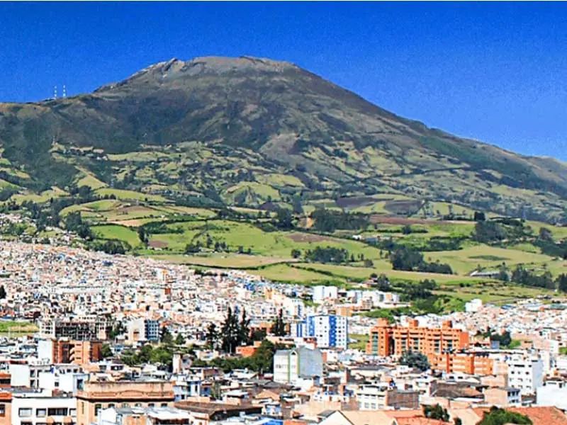
The capital of the department of Nariño is San Juan de Pasto, a city located at 2,527 m above sea level in the Pastos knot, on the Andes mountain range. From Pasto it is easy to visit several neighboring municipalities that offer volcanic landscapes, indigenous traditions, and a unique gastronomy in Colombia.
- Tangua
- Chachagüí
- La Florida
- Consacá
- El Tambo
- Sandoná
- Ancuyá
- Linares
- Nariño
- Funes
- Buesaco