Climate of Guaviare
Temperature, thermal floors, rainy seasons and best time to visit Guaviare. Complete climate data by municipality.
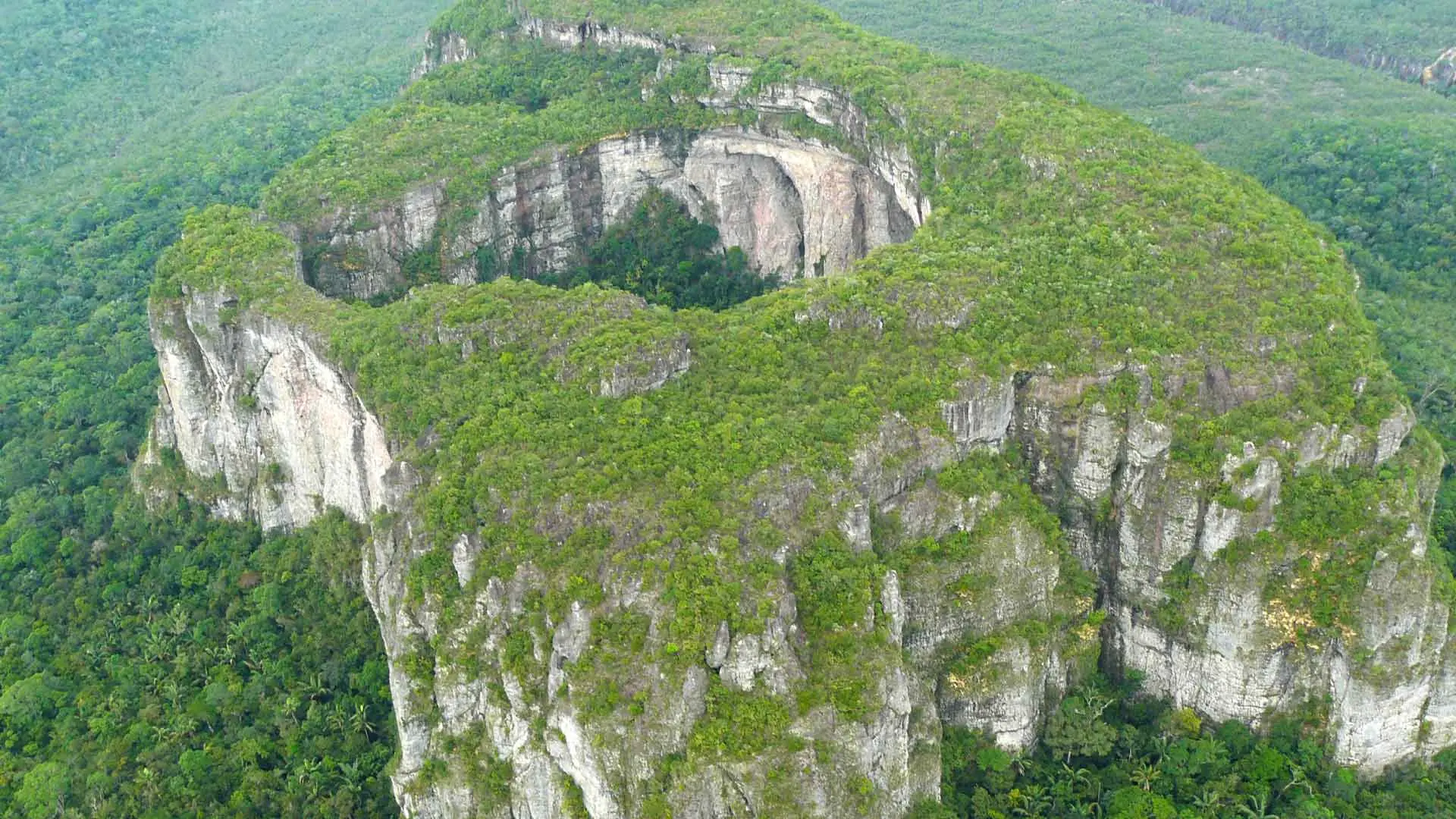
The department of Guaviare occupies a transition zone between the Eastern Plains and the Amazon, giving it climatic characteristics of both regions. San José del Guaviare, its capital, has temperatures of 25 to 30 °C with high humidity. Colombia's most emblematic tepui —the Sierra de Chiribiquete, a World Heritage Site— rises in Guaviare with its inaccessible sandstone plateau, generating its own microclimates on its walls and summits. The Guaviare River visually separates the plains to the north from the Amazon rainforest to the south, and this transition is also reflected in the climate: more seasonal to the north, rainier to the south.
THERMAL FLOORS OF GUAVIARE
Temperature in Guaviare varies by altitude. These are the department's thermal floors:
| Thermal Floor | Altitude | Temperature | Municipalities |
| Warm Orinoco-Amazon transition | 150 – 500 m | 25 – 32 °C | San José del Guaviare, El Retorno, Calamar, Miraflores |
RAINY AND DRY SEASONS IN GUAVIARE
Unimodal regime: rainy April–November, dry December–March. San José del Guaviare receives 3,000–3,800 mm annually. The dry season is more marked than in the pure Amazon, more similar to the plains. Rivers rise notably between June and September.
TEMPERATURE BY MUNICIPALITY IN GUAVIARE
Average annual temperatures of the main municipalities of Guaviare:
| Municipality | Average Temperature |
| San José del Guaviare | 27 °C |
| El Retorno | 27 °C |
| Calamar | 28 °C |
| Miraflores | 28 °C |
BEST TIME TO VISIT GUAVIARE
December to March: dry season, ideal for visiting Chiribiquete (with special permit) and savanna areas. The crystalline streams of Guaviare are more visitable in the dry season. For river ecotourism, May–June when rivers begin to rise.